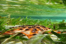
Pramaditya Wicaksono Develops Digital Image Processing Tools for Seagrass Mapping Climate ActionLife on LandMaritime, Aerospace, and Intelligent SystemResearch Monday, 11 April 2022 Geographic Information Science lecturer Dr. Pramaditya Wicaksono and a team of researchers have developed a digital image processing toolbox for automatic mapping of seagrass sequestration and aboveground carbon stocks.